



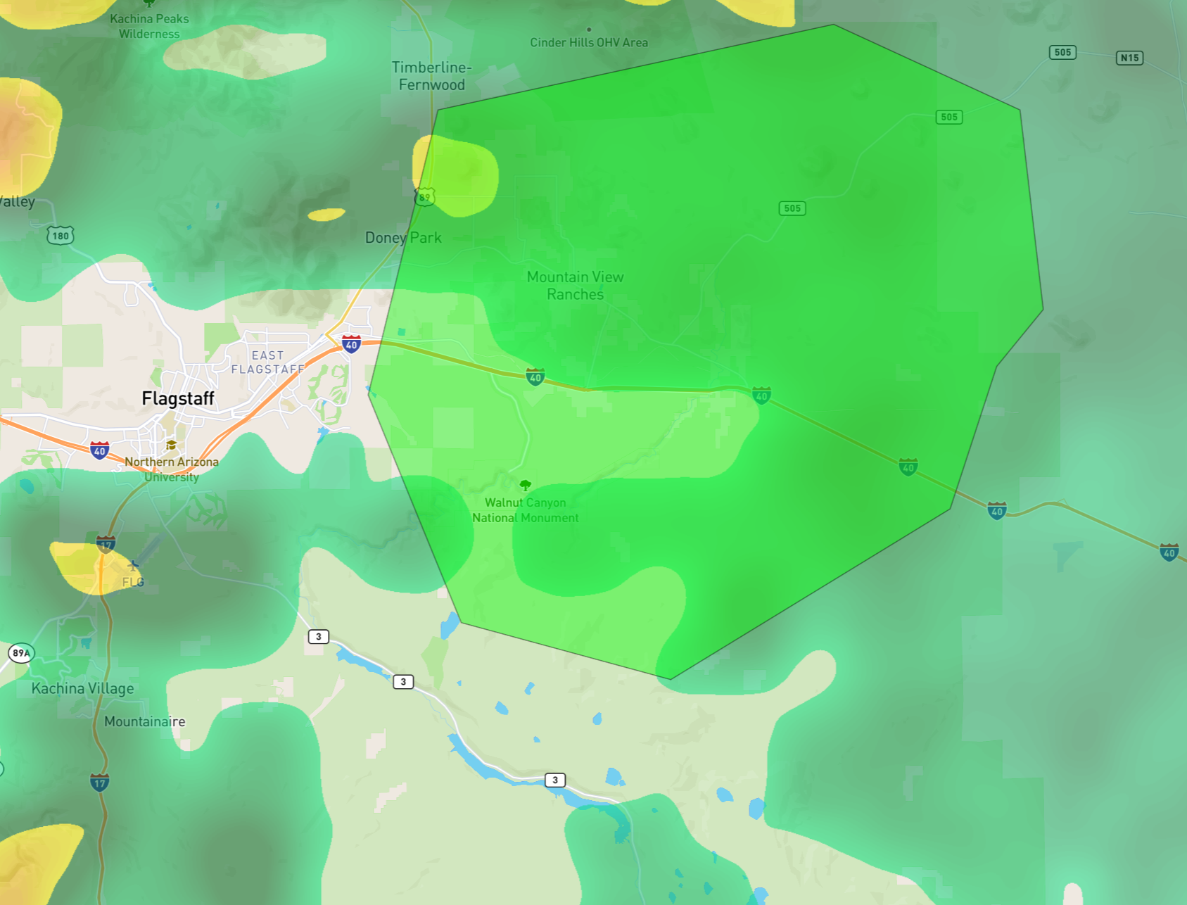
Flash Flood Warning
The National Weather Service in Flagstaff has issued a * Flash Flood Warning for… Coconino County in north central Arizona… * Until 630 PM MST. * At 330 PM MST, Doppler radar indicated thunderstorms producing heavy rain across the warned area. Between 1 and 1.75 inches of rain have fallen. Additional rainfall amounts of 1 to 2 inches are possible in the warned area. Flash flooding is ongoing or expected to begin shortly. HAZARD…Life threatening flash flooding. Thunderstorms producing flash flooding. SOURCE…Radar indicated. IMPACT…Life threatening flash flooding of creeks and streams, normally dry washes, urban areas, highways, streets and underpasses. * Some locations that will experience flash flooding include… Flagstaff, Doney Park, Fernwood, Pioneer Valley, Macann Estates, Walnut Canyon National Monument, Mountain View Ranches, Winona, Cosnino and Angell. This includes the following highways… Interstate 40 between mile markers 203 and 216. U.S. Highway 89 between mile markers 422 and 424. Route 66 between mile markers 202 and 204. This includes the following recreation areas and campgrounds… Picture Canyon Preserve. This includes the following creeks, washes and rivers… Youngs Canyon, San Francisco Wash, Padre Canyon and Walnut Creek. PRECAUTIONARY/PREPAREDNESS ACTIONS… Flooding of washes and creeks will occur, some dirt roads will become muddy and impassable. Paved roads and underpasses could become flooded as well. && FLASH FLOOD…RADAR INDICATED; FLASH FLOOD DAMAGE THREAT…CONSIDERABLE